5G technology can contribute to the integration of drones in airspace
If drone technology is to really take off, it requires that drones are integrated into the airspace and can fly alongside manned aviation. In the research project GENIUS, researchers from SDU, along with DTU, companies, and organisations, have shown how 5G technology could be part of the solution.
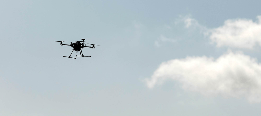
There are high expectations for the future uses of drones. From flying taxis and healthcare drones to infrastructure monitoring, rescue operations, and the transportation of spare parts to offshore wind farms.
There’s just one problem.
All of this can only become a reality if drones can be integrated into the airspace to fly alongside manned aviation and beyond the visual line of sight of drone operators, known as BVLOS. As things stand today, this is only possible to a small extent.
But now, a part of the solution is on the horizon. In the research project GENIUS, researchers from the University of Southern Denmark, along with DTU, Ericsson, TDC, HHLA Sky, and several other partners, have demonstrated how 5G technology could contribute to the integration and to a safe scaling of drone technology in Denmark.
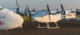
Together, the partners have developed new drones with integrated 5G technology and a traffic management system that, via 5G, can establish connections to and locate drones, create corridors in the airspace where drones can safely fly, and even interrupt a drone operation and temporarily close the airspace if, for example, the police suddenly need to operate in the area.
“What has been great about this project is that it wasn’t just a theoretical exercise. We actually tested the systems, conducted the flights, and integrated the solutions from the different partners, both on a technological and operational level,” says Sebastian Törsleff from HHLA Sky, who provided the traffic management system for the project.
“Also, the project combined industry expertise on the one hand and research expertise on the other. In projects like these, it is always a good idea to bring in different perspectives,” continues Sebastian.
The advantages of 5G
Most people probably know 5G best as the little icon on their phone that indicates good mobile network coverage.
When it comes to drones, 5G technology is interesting because it can be used to establish a stable and dependable connection to the drones even in areas with limited capacity. In the GENIUS project, Ericsson succeeded in developing a new method for monitoring drone performance in real-time over a live TCC NET network. This will make it significantly easier to fly BVLOS.
5G can also be used for several other purposes, such as improving drone flight and public safety.
For instance, through the network you can locate the drones accurately on a centimeter scale, and you can produce what is called a SIM density map, i.e., a dynamic real-time overview of how many phones and thereby people are in a given area. This can be used for risk assessments and to direct drones outside of areas with many people.
New drone strategy
The next steps will be to test the systems out in the real world, not just at the drone center in HCA Airport in Odense.
“We have taken some decisive steps in GENIUS towards integrating the drones with manned aviation in the lower airspace. We still have big challenges ahead that we’re working on, and we are actively applying for more funding to be able to continue,” says Kjeld Jensen, associate professor at SDU’s drone center.
“We also look forward to the new national drone strategy, which will be released in the autumn, and which several partners in the project have helped to develop as part of the expert groups. Hopefully, the new strategy will form the basis for future legislative work in the area,” continues Kjeld.
About the project
GENIUS was a three-year research project supported by the Innovation Fund. It began in 2021 and ended in spring 2024.
The goal was to lay the foundation for a future traffic management system for drones using 5G technology, which enables the integration of drones with manned aviation in the lower airspace.
In total, there were 10 partners in the project: The University of Southern Denmark, DTU (Technical University of Denmark), TDC Net, Ericsson, HHLA Sky, Meck Consult, Science Ventures Denmark, Airplate, SDFI, and Naviair.
Additionally, the Danish Environmental Protection Agency was also involved.
As a spin-out from the research project, the company AirPlate was founded. They make digital license plates for drones so they can be identified from a distance, which EU legislation requires. They also produce an AirMap that tracks drone and air traffic in Denmark.
During the project, TDC NET and Ericsson received the prestigious GSMA Foundry Excellence Award at the MWC conference for the telecommunications industry for their work in the project.
Im Drones PR-Portal erscheinen Nachrichten und Meldungen von Unternehmen aus der Drone-Economy. Für die Inhalte der Pressemitteilungen sind die jeweiligen Unternehmen verantwortlich.


